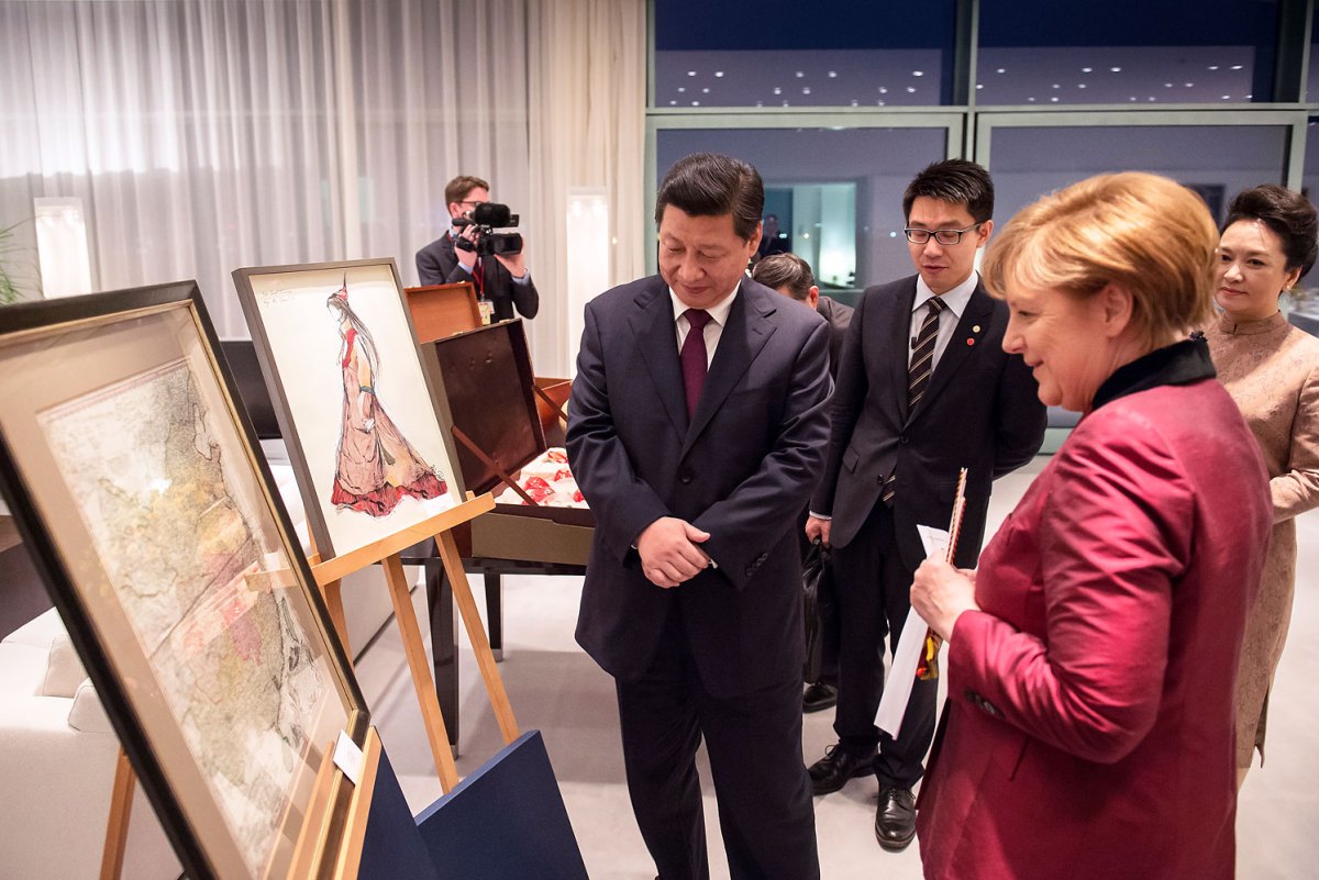
German Chancellor Angela Merkel presents Chinese President Xi Jinping the map of China from the 18th century at the Chancellor’s Office, in Berlin
Chinese President Xi Jinping met German Chancellor Angela Merkel during his recent visit to Europe. They exchanged gifts at a dinner hosted in his honour by the Chancellor. When Merkel presented Xi with a 1735 map of China she may not have realised what a storm she would raise: the gift was reported across the world bringing a welcome spotlight onto Tibet.
The antique map, which was made by French cartographer Jean-Baptiste Bourguignon d’Anville and printed in Germany, was based on early geographical surveys done by Jesuit missionaries in China and represented the “summation of European knowledge on China in the 18th-century.” It shows China mostly without Tibet, Xinjiang, Mongolia, or Manchuria, territories currently occupied by China. The islands of Taiwan and Hainan are shown with a different colour border: Hainan is a part of modern China, while Taiwan is very much disputed. This depiction is at odds with how history is currently taught in China where students learn that these areas have been inalienable parts of China “since ancient times”.
China’s official media outlets reporting the visit have either not mentioned the map, or have published reports of a different map which includes Tibet, Xinjiang, Mongolia, and large swathes of Siberia. This larger map was produced by British mapmaker John Dower in 1844 and published by Henry Teesdale & Co. in London, and was not the gift from Merkel to Xi.
Both maps have appeared on Chinese social media and have elicited a storm of responses. Hao Qian, a finance reporter, remarked that the map is “quite an awkward gift.” Writer Xiao Zheng blasted Merkel for trying to “legitimise the Tibet and Xinjiang independence movements.” Architect Liu Kun wrote, “The Germans definitely have ulterior motives.” One commentator blamed the mapmakers: “At that time German priests [sic] were not allowed to travel in such areas.”
One Internet user declared that the map was not a message about Tibet or Xinjiang, saying “After all, you can’t use a map of the 13 colonies of the United States made in 1776 to tell Americans that Texas or California is not US territory.”
 Print
Print Email
Email